





Custom maps
Admin > Settings > Maps
By default, Metabase uses OpenStreetMap tiles for pin and grid map visualizations, and comes with two built-in region maps - world countries and US states. You can change the tiles used for pin and grid maps, and upload additional region maps.
To find the map settings:
- At the top right of the screen, click grid icon > Admin > Settings.
- Select
Mapsfrom the navigation on the left.
Map tile server
By default, Metabase uses the OpenStreetMap tile server for pin and grid maps. If your organization needs a different look or level of detail, you can point Metabase at a different tile server.
The map tile server sets the background imagery for pin and grid maps. It’s not the same as a custom region map, which uses a GeoJSON file to draw region shapes.
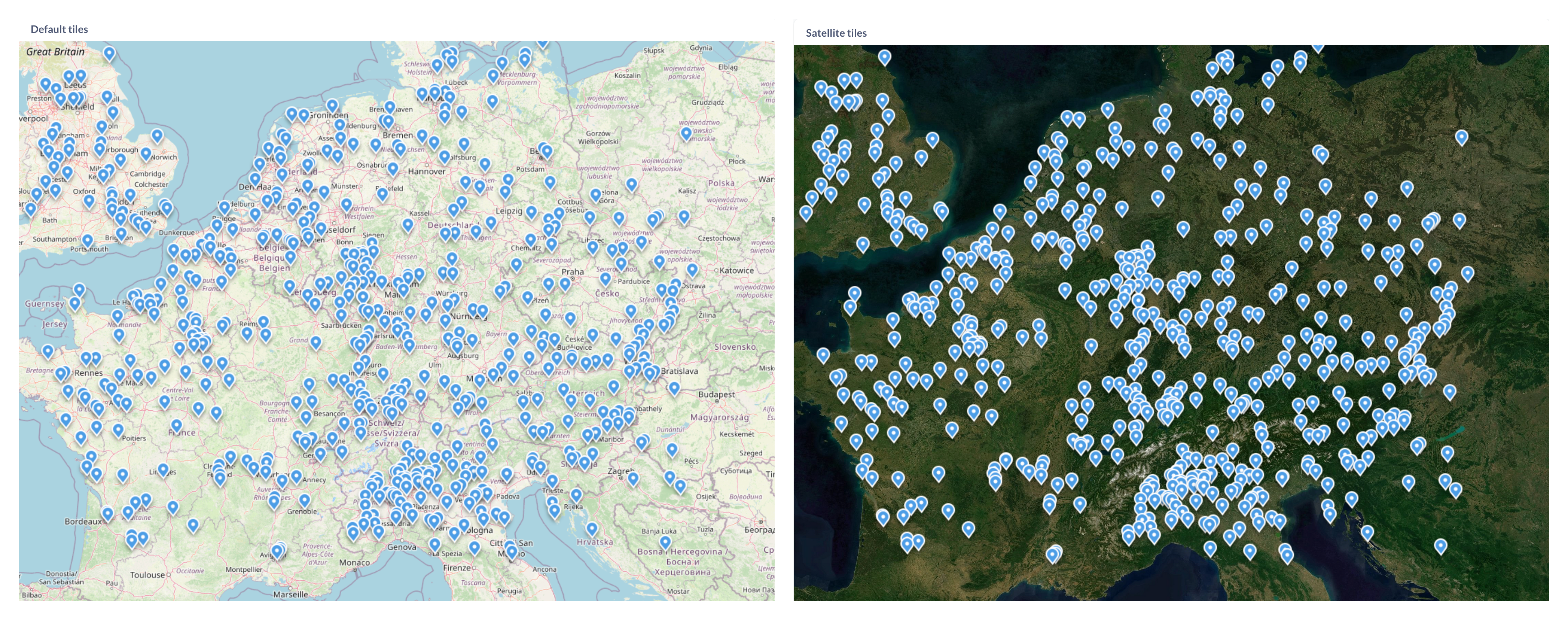
To change the map tile server:
- Go to Admin > Settings > Maps.
- Under Map tile server URL, enter the URL template for your tile server.
Use a raster tile URL template
Metabase renders raster tiles (PNG or JPEG).
The URL must be a template with {z}, {x}, and {y} placeholders, and optionally {s} for a subdomain. Metabase fills in the zoom level and tile coordinates as people pan and zoom around the map. The default OpenStreetMap URL is a good example:
https://{s}.tile.openstreetmap.org/{z}/{x}/{y}.png
Tile server URLs must start with http:// or https://.
Don’t put a private key in the tile server URL
Metabase sends the map tile server URL to the browser, including in embeds and public links. Anyone who can view a map can read the URL and any key in it.
If your tile server needs a key, use a public, client-side key and restrict it to the domains you serve Metabase from. Mapbox, for example, calls these public tokens.
Metabase uses a single tile server per instance. You can’t specify different tiles for different maps.
Custom region maps
Metabase comes with two built-in region maps: world map with countries and United States map with states.
If you need a map of other regions - like EU countries or NYC neighborhoods - you can specify a GeoJSON file containing region information. You can often find GeoJSON maps by searching online for “[Your region] + geojson”, like “NYC neighborhoods GeoJSON.” Many community members and government organizations have already developed map files for common regions. You can also create your own GeoJSON with a tool like MapShaper or GeoJSON.io.
Custom geoJSON requirements
Your GeoJSON file should:
- Be less than 5 MB in size.
- Contain polygon features defining regions (not just points or coordinates)
- Use geographic coordinates (latitude and longitude) to define region polygons. Metabase doesn’t support projected coordinates, so you’ll need to convert projected coordinates to geographic coordinates.
- Accessible by a public URL. Currently, you can’t upload a GeoJSON to Metabase.
Add a custom map
To add a custom map:
-
Click the grid icon, then go to Admin > Settings > Maps > Custom Maps.
-
Click Add a Map.
-
Enter a name for your map.
-
Provide the URL to your GeoJSON file.
-
Specify the JSON properties that should serve as region identifier and region name.
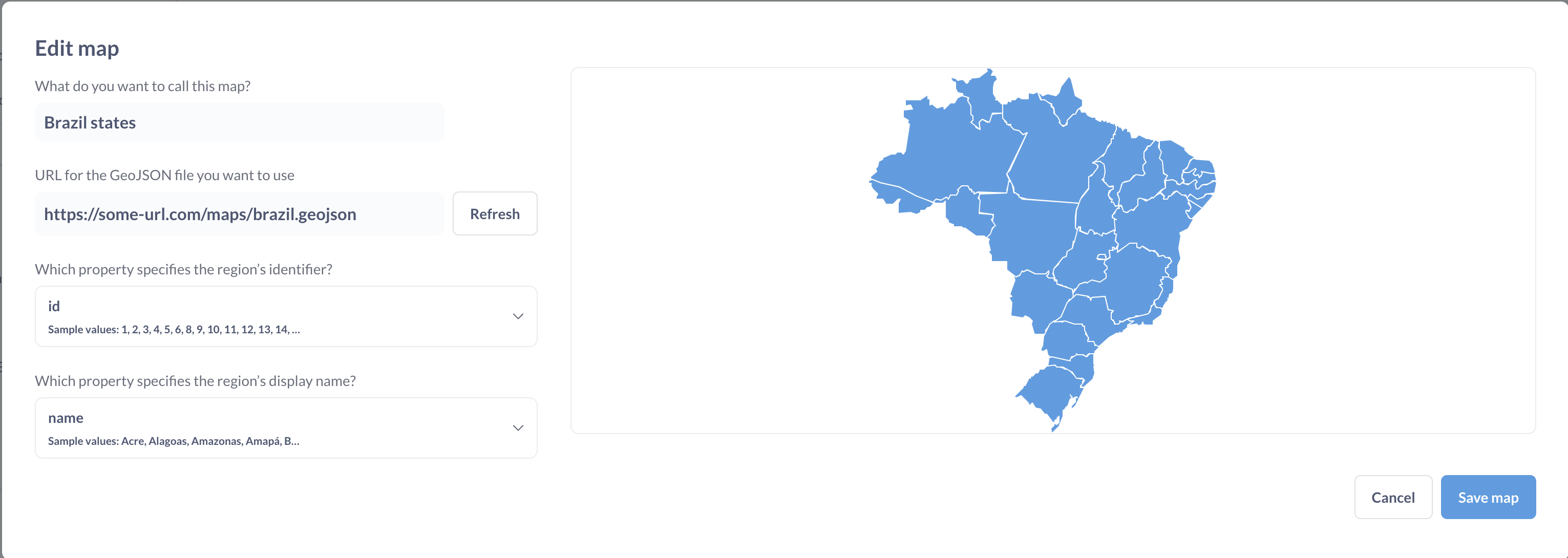
- Name of the map will be displayed in the region selector for custom region maps.
- Region’s identifier is a GeoJSON field that identifies your region. The values in this field should match how the data refers to the regions. The field doesn’t need to match the display name.
- Region’s display name is a GeoJSON field that specifies how maps will display region names. This field can be different from the region’s identifier.
To pre-load one or more region maps when Metabase starts, you can use the environment variable MB_CUSTOM_GEOJSON or a config file option custom-geojson .
To disable the creation of custom maps, use the MB_CUSTOM_GEOJSON_ENABLED or a config file option custom-geojson-enabled.
Read docs for other versions of Metabase.